Upper mustang trek
Off the Beaten Path
Excellent
5/5
Duration
13 Days
Max. Altitude
3840 m.
Difficulty
Moderate
Best Season
Spring | Autumn
Transportation
Private Vehicle / Flight
Accommodation
Lodge during Trek
Starting Point
Kathmandu
Ending Point
Kathmandu
Overview
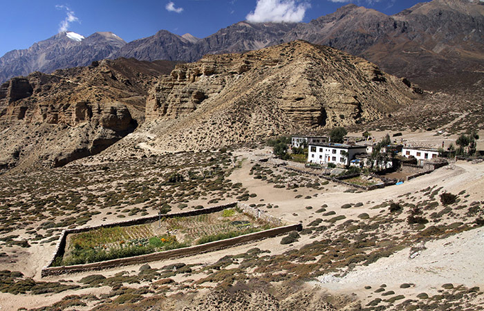
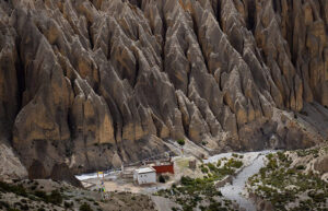
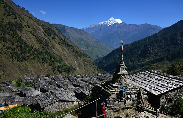
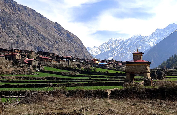
The name Mustang refers to the parched, Tibet- like region at the northern end of the Kali Gandaki river. The name Mustang also denotes the entire district along the Kali Gandaki from the Tibetan border south to Ghasa whose district headquarters are in Jomsom, at about the centre of the district. The restricted area of Tibetan influence that was opened for outsiders only after 1991 lies north of Kagbeni and Nepalese refer to it as Upper Mustang. It consists of two distinct regions: the southern part, with five villages (Chele, Ghyakar, Chhuksang, Tangbe and Tetang) inhabited by people related to the Manangis (indigenous people of Manang); and the northern area (the ancient kingdom of Lo) where the language, culture and traditions are almost purely Tibetan. Mustang is in the Himalaya’s rain shadow, which has less rain than the rest of Nepal. Villages in this area are some hours apart and emerge at a distance almost as mirages. ‘Lo’ refers to Upper Mustang and its capital is called Manthang, which in Tibetan means ‘plain of aspiration’, and people call it Lo Manthang.
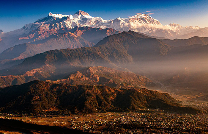
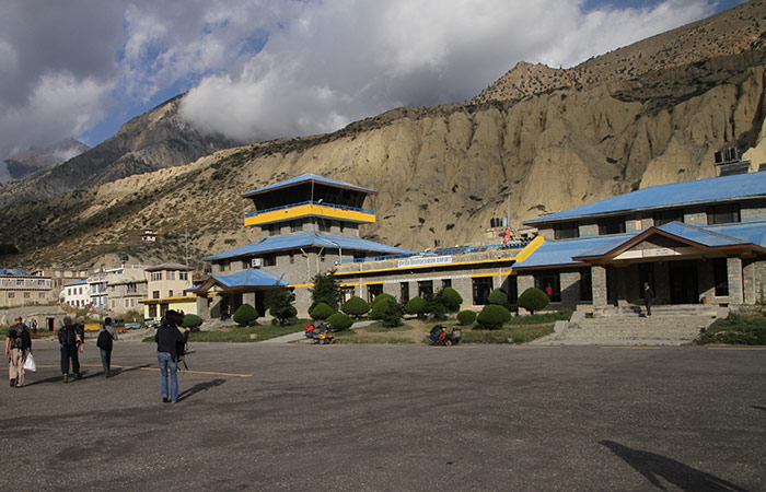
The journey starts with a dramatic flight from Pokhara that flies over the route of the Annapurna Circuit trek and grants us some thrilling scenery as we close by the ridge-top village of Ghorepani and drop down into Kali Gandaki Valley. Heading north, we pass between the Dhaulagiri and Annapurna massifs with impressive views of Dhaulagiri on the left before landing on the airstrip of Jomsom.
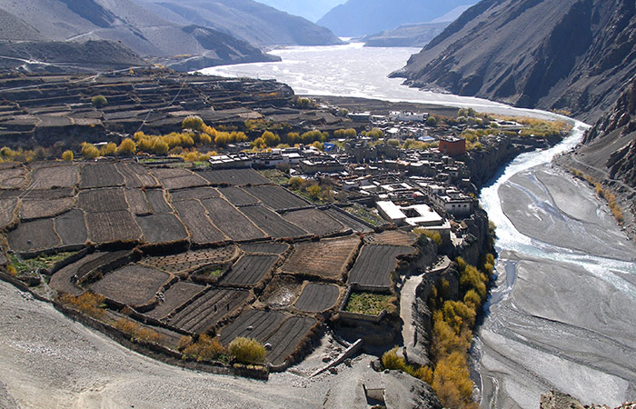
As we kick off from Jomsom, the trial goes along the river valley past Eklai Bhatti and, shortly after, to the green oasis of Kagbeni. Pacing out of Kagbeni onwards to the north is the restricted area. You pursue the trail that traverses labyrinth of narrow alleys Tangbe and leave behind some unapproachable caves in the monsoon on the way to Chele where the people keep sheep horns on their doorways.
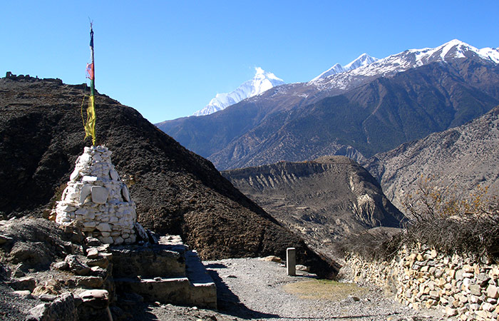
The route from Chele to Lo Manthang is at high elevation barren section soaring in and out of the immense side valleys of Kali Gandaki River. The trail first crosses Chela La pass (3630m) and follows the huge side valley making a long gradual descent to Samar with the background view of Annapurna Himal dominated by Nilgiri far to the south, and past numerous ups and downs and another two passes; Yamoda La pass (4010m) and Shyangmochen La pass (3850m), the trail leads you to Tamagaon.. Continue further, pass through Ghemi with a large settlement of white-washed houses, cross the longest and most spectacular stretch of mani wall of Nepal and follow the trail which ascends a rocky channel and the Choya La pass (3870m) ahead, eventually bringing you to the impressive Charang, a maze of fields where the houses are separated by stonewalls. From here, the trail traverses Charang Chu past the Tholung valley, goes by a stream and appears into an imposing expansive thoroughfare with a desert like terrain. A short descent from Lo onwards a stream and a climb turns you up onto the walled city of Lo Manthang, your destination, where the houses are compact with four temples and four storey imposing palace of Mustang King.
Additional two days to roam around the city and some other villages by a horse will definitely tempt you back to Ghemi via alternative high route through monastery at Lo Gekar. The trail traverses the Marang La pass (4050m) and Mu-I La pass, which goes through alpine meadows and fluted red and purple cliffs, into an eroded channel, eventually leading us to Dhakmar, meaning ‘Red Crag’, and thereafter walk to Ghemi, the most pleasant walk in the whole kingdom, from where we retrace back to Jomsom.
Itinerary
Day 01
We fly early in the morning into the hub of the Annapurna region to the gateway of the Kali Gandaki River, renowned for the deepest valley in the world, 3 times larger than the Grand Canyon, and land on the mountain airstrip of Jomsom, the administrative headquarters for Mustang district. After taking lunch in one of the lodges, we commence our trek chasing the trail through the main part of the village. We continue on a rocky path that runs along the river. Crossing the Panga River, the trail follows a walled tree plantation; and after a short ascent, we reach Eklai Bhatti which eventually leads to the village of Kagbeni, a green oasis at the intersection of the Jhong River and the Kali Gandaki
Day 02
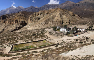
This day we follow the high trail or the riverbed route, depending on the height of the river. The trail ascends immediately to a ridge and then descends and climbs over another ridge. After few more ups and downs and a short climb, the trail gets you to Tangbe, the labyrinth of narrow alleys amongst white washed houses, fields of buckwheat, barley, wheat and apple orchards. Leaving Tangbe you come across Gompa Kang and some caves on the west bank of the river. The Gompa is inaccessible from the town when the water level in the Kali Gandaki is high. Further along, walk for an hour to reach Chhuksang village at the confluence of the Narshing River and the Kali Gandaki. Cross the Narshing river either wading or hopping from boulder to boulder, go past numerous ups and downs to end up at Chele. The cultural transformation from the Manangi to that of Tibetan is distinctly evident in this village, where most of the houses have unique sheep horns above the doorways and many twigs in the shape of a cross with threads in five colors woven in a diamond- shaped pattern, known as zor, supposedly used for warding off evil spirits.
Day 03
The rest of the trek to Lo Manthang is via high altitude barren region, climbing in and out of the vast Kali Gandaki valley. The trail from Chele is up a steep spur to a cairn with a view of Ghyakar, and its fields encircled by a long wall of packed earth. The ascent continues past Chele La pass at 3630m and enters a huge side valley making a long gradual descent to Samar, which is surrounded by a grove of poplar trees and is a chief stopping place for horse caravans. Looking around, we can still see the Annapurnas and Nilgiri in the south. The trail climbs up and down past few houses in Bhena before approaching another pass, the Yamdo La pass at 4010m. After passing over Yamdo La, descend steeply following a ridge to Shyangmochen. A brief subtle climb to the Shyangmochen La at 3850m puts you on a route that enters another huge valley which, in turn, leads you to an intersection. Head to the left to reach our overnight destination, Tama Gaon.
Day 04
Passing below Tama Gaon, follow the direct trail which later becomes a rigid climb across the head of the valley to the Nyi La pass at 4020m, locally known as Jaite La. The descent from the pass is fairly gentle. But then, the trail drops steeply to Ghemi, a large settlement distinguished by scores of white washed houses surrounded by hectares and hectares of field.
Day 05
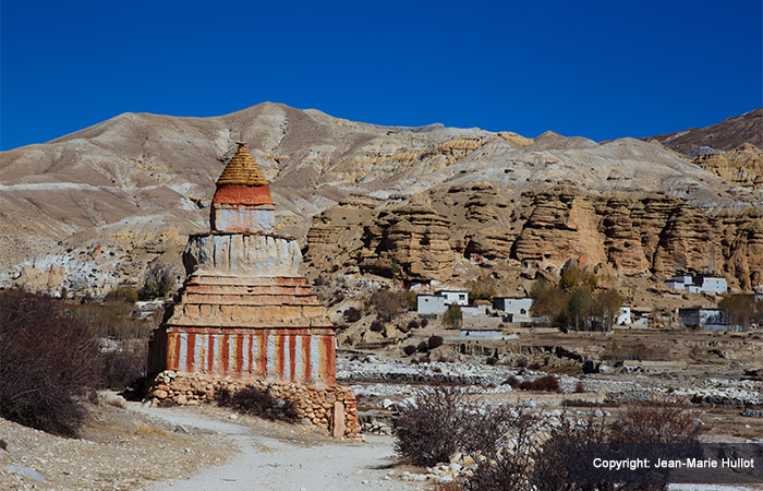
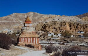
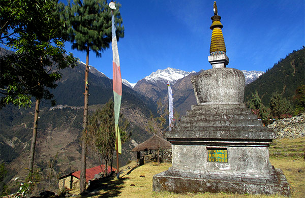
Drop down to a bridge across the Tangmarchu and climb up onto a broad plain. What we’re going to witness now is quite remarkable- An undisputed contender for the longest prayer wall in Nepal, more than 400m long, about 2.5 m tall mani wall adorned by the hues of mountains reflecting on its surface. Beyond the mani wall, the trail climbs a rocky channel, and then traverses to the Choya La pass at 3870m. Later, gently descend and ramble across the fields to Charang.
Day 06
Leaving behind Charang, we tread on a steep rocky trail to a cairn on a crest into the Tholung valley. The trail then crosses a stream, then becomes an expansive thoroughfare traveling across desert like terrain tinted in hues of grey and yellow. A short descent from Lo advances you to a trail that crosses a stream and climbs up on the plateau of the walled city of Lo Manthang, the entrance of which is at the northeastern corner.
Day 07-08
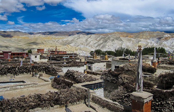
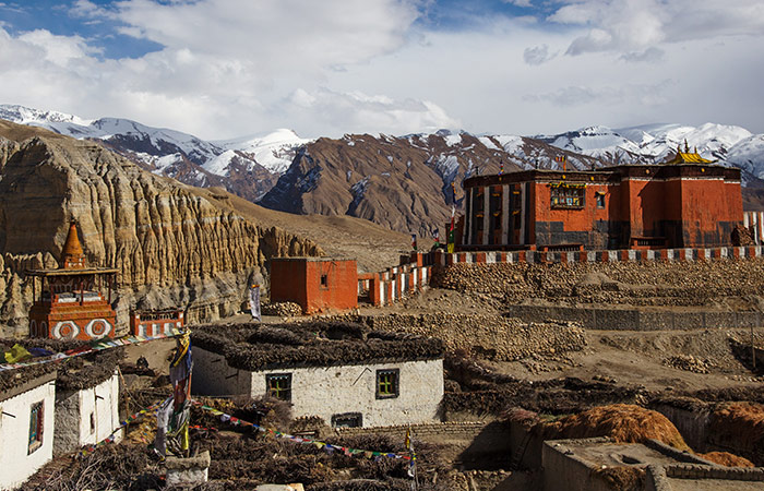
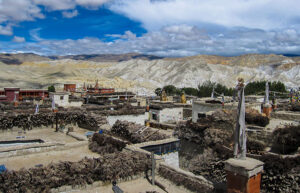
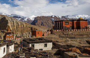
In Lo Manthang, there are around 150 houses, nestled in close proximity to each other. The doors of most houses open onto a two storey open central courtyard and the floors are used as the storage space. A wooden staircase leads to the first storey, which characteristically has a veranda overlooking the courtyard and doors leading off to living rooms and the kitchen. A jagged log leads to the roof surrounded by enormous stacks of juniper twigs and firewood. Every house has toilet on the upper floor that drops into a ground floor chamber and ashes from the hearth are dumped into the toilet to eliminate smell, and the resulting product is used as organic fertilizer. The best way to get a look at the town is to climb up onto the roof of one of the houses. There are four major temples within the periphery of the city walls- namely, Jampa Lhakang, Thubchen Gompa, Chodey Gompa and Choprang Gompa. The King’s palace, a magnificent four storey building, is in the centre of the city. Though only ceremonial, the king is still respected by the locals and consulted about many issues by villagers through Lo. You have two full days to look around the city and the surrounding area. Savour the breathtaking views of the Annapurnas, take a walk to Namgyal Gompa, ‘the monastery of victory, situated in a spectacular setting atop a deserted ridge.
Day 09
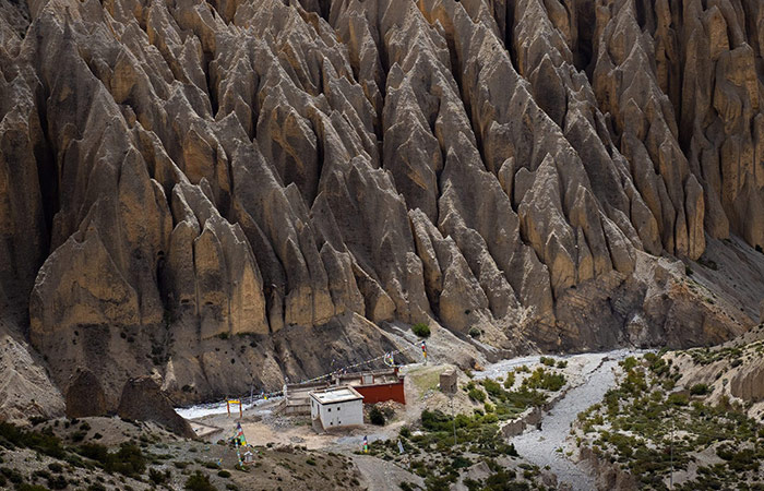
While returning back to Ghemi, we take an alternative high route through monastery at Lo Gekar heading west, contouring the top of the valley and climbing gradually to the Marang La pass (4050m). amidst the landscapes that are exceptionally gorgeous. After we get into the village of Lo Ghekar, a little further down, the trail reaches grassy pastures on which Ghar Gompa stands, which looks more like a house than a Gompa and is surrounded by basic living quarters for monks and pilgrims. This Gompa is festooned with paintings and statues and has numerous large prayer wheels as well. We keep on the route to our next pass, the Mu-I La, pass through alpine meadows, drop steeply down a rocky path through fluted red and purple cliffs, into an eroded channel, eventually leading us to Dhakmar, meaning ‘Red Crag’. The surroundings here are relatively fine looking and the remaining hour’s walk back to Ghemi is one of the most pleasant paths in the whole Kingdom.
Day 10-12
Continue to retrace back to Jomsom from Ghemi passing through Tamagaon, Shyangmochen and Samar making the night stops at Chele and Kagbeni, and the following day the descent to Eklai Bhatti eventually leads us to Jomsom where you have ample time to relax.
Day 13-14
We take an early morning flight back to Pokhara where you can relax sitting by the Phewa Lake with the magnificent backdrop views of Annapurna range, including the Fish-tail summit of Machhapuchhare or indulge in shopping and recreation. You can also visit some famous landmarks of the city.
Day 15
The very next day, we take a flight back to the capital. Time permitting, you can roam around the inner sections of the city, make a visit to the numerous temples and shrines. Finally, make preparations for your flight out of Kathmandu.
Included
- Per itinerary with tour guide, vehicle & entry fees inclusive
- All meals – full board (breakfast, lunch, dinner) during the trek as per given itinerary
- Twin sharing tea-house/lodge accommodation during the upper mustang trek
- upper mustang trek experienced trek leader (English speaking, First Aid and Eco-trained), one Sherpa porter (per two clients) and one assistant guide (in a group) included salary with insurance
- upper mustang conservation entry fee, TIMS permit, plus all major permits and entry fees inclusive
- Sleeping bag with liner, down jacket, upper mustang trek trekking map, printed itinerary etc.
- Safe drinking water purified by Iodine tablet/sterilized by Steripen
- Complementary company duffel bag during upper mustang trekking and company t-shirt
- Comprehensive medical kit bag (First Aid bag)
- All required government and local taxes etc.
Excluded
- Nepalese visa and international airfare
- Excess baggage charge (Domestic allow only 15kg maximum)
- Lunch and dinner in Kathmandu except mentioned
- Travel and rescues insurance (Book your travel insurance in advance)
- Personal expenses e.g phone calls, laundry, bar bills, hot shower, battery recharge & extra porters
- Tips for driver, trekking guide, and trekking Sherpa and trekking porter
- Any extending trips besides 12 days upper mustang trek
- Any service doesn’t including in service column

