15 Days
4380 m.
Moderate
Private Vehicle
Spring | Autumn
Lodge during Trek
Kathmandu
Kathmandu


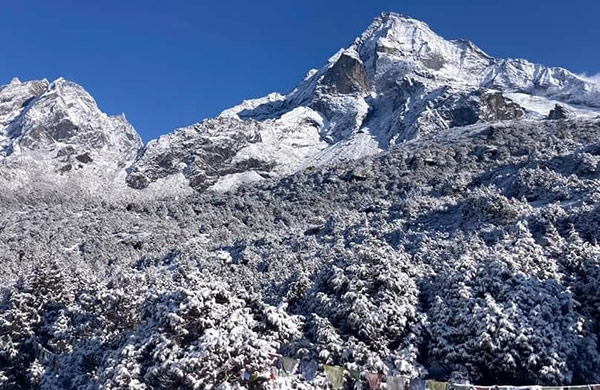
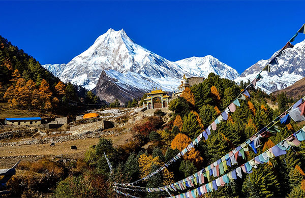
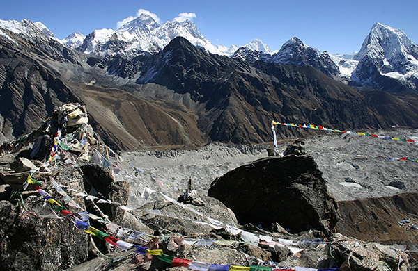
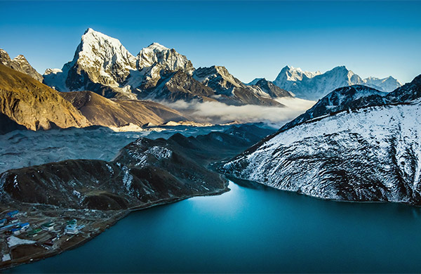
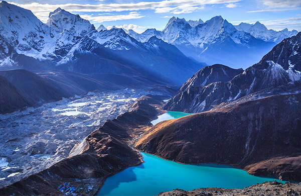
Langtang region is third popular trekking trail route after two famous trekking trails Everest region and Annapurna region, this trekking trail is one of the best and perfect combination of moderate and diligent trekking. Langtang region is situated In north of Kathmandu in center Himalaya region, Langtang are was declared the National park in 1976. And this National park is second largest National park in Nepal after Shy-phoksundo National park, in this area lama, yolmo, Tamang, Bhote and Tibetan peoples are lived. And other highlight of in this trekking route are forest of Rhododendron, varies type of landscape, tree forest to grass land, heart touching spectacular panoramic snow capped view of Langtang and Ganesh Himalayan range. In this area we can see the varies species of wild animal like red panda, Himalayan black bear, wild dog, Himalayan Thar, Ghoral (mountain antelope), and more than 250 species of birds. The charm of the trek lies in the fact that it is a less- frequented trek in comparison to some of the other much publicized treks in Nepal, which in no less means grandeur of the landscape, views and the excitement of the ensuing challenge that entails.
In a nutshell, this remote, sparsely populated region north of Kathmandu rewards its visitors with wide spectrum of breathtaking scenery, delightful villages, fascinating cultural and enriching spiritual experience, combined with the stimulating physical challenge.
The road heads north-westward through Balaju before making a steady climb to the rim of the Kathmandu valley, to the pass at Kakani. Vistas of the Manaslu massif, Ganesh, Langtang and Jugal Himal en-route (72kms 4 hrs) on the winding descent gets you to the Trisuli bazaar. From Trisuli onwards, the road condition deteriorates, probably giving you the ride of a lifetime, all the way to Dhunche (50 kms) and another 15 kms to Syabrubesi. (O/nt at a simple, roadside local lodge with attached bath facility)
A.M. walk descend to the camping area then trail turns northwards to a suspension bridge over the Bhote Kosi. The trail on your right from the bridge leads to the village of Old Syabru. Past the village, a fairly gentle trek through the woods, replete with monkeys, to reach Doman. Then, climb steeply over a rocky ridge to meet the trail from Thulo Syabru. The entire reaches of the region are a deciduous zone rich in birdlife and flowers that harbors the elusive red panda. A long climb through forests gets you to another trail junction, beyond which the gradient eases as the trail gets you to close proximity of Langtang Khola. Further half an hour climb to a bridge over the Langtang Khola, then cross the bridge to the north bank, trail once more climbs through the wooded gorge alongside a series of waterfalls to Langtang View Hotel, and then ascends further to Lama Hotel.
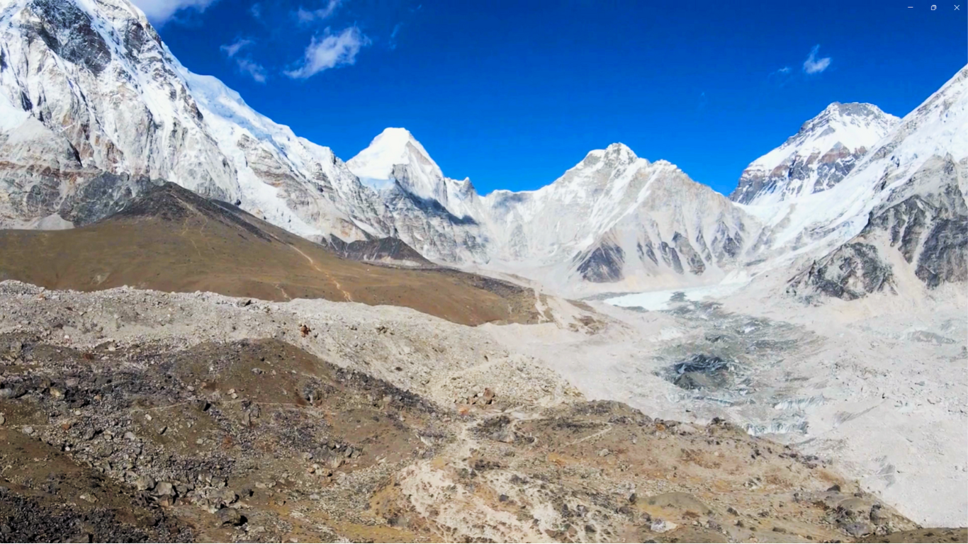
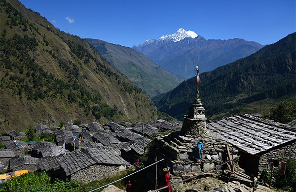
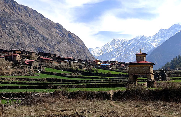
Day starts on the trail that continues to follow the Langtang Khola, gaining more altitude all along, to Ghora Tabela (Horse Stable) at 2970m., where the exquisite views of Langtang Lirung appear over the skyline. Further ahead, the path remains fairly constant before a steepish uphill climb brings you to the upper section of the valley. The trail then zigzags higher and higher to Thangshep. The valley broadens and curves ahead as the trail continue to rise interrupted by pleasant level-stretched sections. The way now channels through dry-stone walls, eventually emerging on to the Tibetan style village of Langtang.
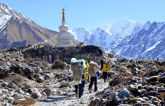
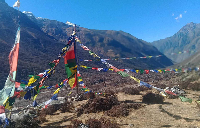
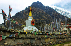
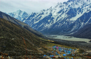
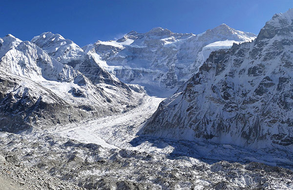
A pleasant morning’s walk through charming mountain scenery will keep your cameras quite busy. Leaving the village, the trail goes across yak pastures and meandering streams before rising up an old moraine, ultimately heading up valley through a series of mani walls with Gengchempo (6387m) forming a prominent landmark to the east. Descend into a small stream bed, and up the other side to yet more mani walls to reach a broad valley past the Tamang settlements of Mundu (3410m) and Sindum (3410m). Beyond these, you continue to gain altitude in modest steps, then cross a wooden bridge over a stream and climb onto moraines as Kyanjin Gompa becomes visible flanked by spectacular mountains, notably Langtang range and Langshisa.
The day will be spent acclimatizing to the conditions, taking into consideration the higher altitudes you’ll encounter in days to come. The highlight of the day is the hike to the picturesque Lantang Lirung Glacier (4300m/1hr uphill) in the afternoon. Or, just roam around the village visiting the famous, half a century old, and cheese factory.
Retrace your steps back over the same route to Lama Hotel.
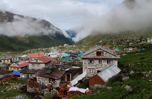
Again take the same route that we trekked on Day 2, wading through the jungle and river valley, until past the Bamboo Lodge where we meet the uphill trail to the left heading towards the Sherpa village of Thulo Syabru.
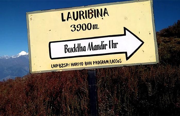
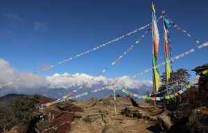
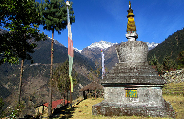
We start with steep uphill trail above the village following the upper trail to Dursagang (2550m). The gradient eases as the trail makes its way through resplendent rhododendron forest to Chandan Bari (3250m), the next major village famous for its landmark, Sing Gompa. The trail cuts across the ridge top and enters a level-stretched section through forests as it crosses the head of a valley. Then trail continues across the head of a final ridge and soon to the village. On the later part of the trek, climb steeply up the ridge, then cross behind the ridge while the trail stays in deep woods to emerge onto a saddle at Chalang Pati (3380m). A final ascent and there you’re in Laurebina amidst the astounding views of Annapurnas, Manaslu, Ganesh Himal and Langtang Lirung.
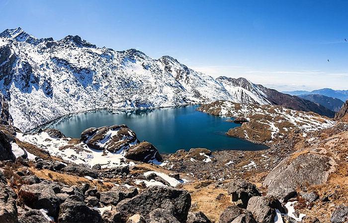
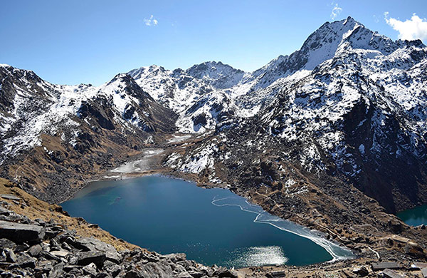
The divine beauty of the holy lake is the high point of the entire trek. Set out on a trail high up on the ridge (4100m), the first of the lakes Saraswati Kunda appears below. The trail then crosses a rocky spur, a short distance ahead the much larger second lake, Bhairabh Kund, comes into picture. Keep to the ridge and finally drop about 20m to the third and largest lake, Gossainkund. Look out for the fabled black rock at the centre of the lake, venerated as the head of Shiva.
The allure, aura and spiritual essence of the area demands at least a day’s halt for the feeling of being in such a special place to sink in. The day can be spent exploring the surrounding hills for extensive views.
The path skirts the north shore of Gossainkund and ascends further through on a rough trail marked with rock cairns towards Laurebina La pass (4610m), gained in a little over an hour from Gossainkund passing three small lakes on the way. The descent from the pass is quite perilous and extreme caution is advised. The descent, initially, is very steep but eases after a while to Bheda Goth (4100m). Descend along the middle of the valley, taking the lower, safer trail to Phedi (3500m). The trail here, along the steep left-hand flanks of the gorge, too is no less perilous with a big drop to the right. Then, ascend to a ridge, across the valley, on a path that looks frighteningly steep and rough as is so. Giving you the respite, the trail descends through a brief patch of forest, climbing in and out of ravines across the head of the valley. Finally, top a final spur overlooking your overnight destination, Ghopte. At night, you can look out beyond the forested lower glen to the lights of Trisuli Bazaar far below and that of Ktm to the south-east.
Long-ranging series of foothill ridges dominate the landscape from this day onwards, having left behind the big mountains. A short day’s trek through the alpine region starts off on a trail that narrows down and drops steeply, continuing up and down across the moraines below the 1992 crash site of Thai Airways plane. Soon you meet the trail that merges with the Helambu Circuit. Tharepati is at a short distance away perched on the crest of the hill ahead.
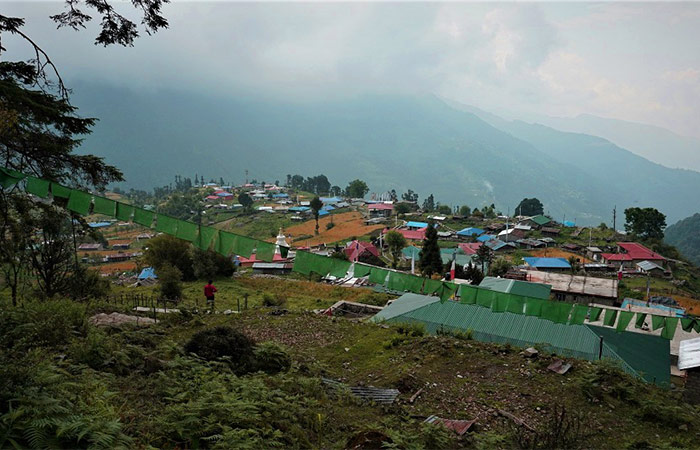
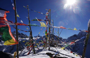
A comfortable day’s walk starts on a trail that immediately arches to the right, briefly along the crest and then drops down the right hand flank across the rhododendron strewn meadows and streams. The well-defined path returns you to the ridge and down stone steps along the ridge crest to another trail junction. Take the right-hand trail to Mangengoth (3150m). Descend slightly and climb again to the main saddle, marked by fluttering prayer flags. An hour from Mangengoth, the forest opens up to a wide hillside to reach another trail junction by the mani wall. Continue straight ahead, again among rhododendrons, to enter the Tamang village of Kutumsang set upon a saddle in the ridge overlooking terraced fields on either side.
The trail passes along the ridge crest turning into a rougher one as you get close to Gul Bhanjyang (2142m). Past the village, uphill again to the ridge, then cross to the right-hand side as the gradient becomes gentler for a while. The way re-crosses to the left-hand side, climbs again and returns to the western flank through oak forest ultimately leading to Namche Danda (2453m). A long descent down stone steps to Chipling follows (2165m). Resuming on a descending trail, zigzagging among terraces, you’ll soon reach Thana Bhanjyang (1780m). Further ahead, the trail branches out into three directions, take the middle one which leads to Pati Bhanjyang (1768m). Just beyond the village, the path again divides, take the right-hand option and make a steep 400m ascent to Chisopani. Morning views from Chisopani are splendid to say the least.
After taking in the great mountain views for the one last time, start on a return trek to Kathmandu. Follow the rising trail for an hour to Burlang Bhanjyang (2438m) through the forests teeming with verdant flora. Go past the abandoned army camp to arrive at a large, strung-out village of Mulkharka (1768m). Descending down through the village on concrete stair case, you reach at the water reservoir of Sundarijal to finally exit from the Shivapuri National Park. Enjoy the sights of thundering waterfalls and follow the pipeline to the end point of the trek at the bazaar where your ride lies in wait to accost you to Kathmandu.
Trekking in Nepal
5/5 Excellent
Trekking in Nepal
3/5 Excellent
Trekking in Nepal
3/5 Excellent
Trekking in Nepal
4/5 Excellent
Trekking in Nepal
5/5 Excellent
Trekking in Nepal
4/5 Excellent
Trekking in Nepal
4/5 Excellent
Trekking in Nepal
1/5 Excellent
Trekking in Nepal
3/5 Excellent
Trekking in Nepal
4/5 Excellent
Trekking in Nepal
1/5 Excellent
Trekking in Nepal
1/5 Excellent
Trekking in Nepal
3/5 Excellent
Trekking in Nepal
4/5 Excellent
Trekking in Nepal
5/5 Excellent
Trekking in Nepal
3/5 Excellent
Trekking in Nepal
5/5 Excellent
Trekking in Nepal
3/5 Excellent
Copyright © 2026 Adventure Challenge Centre. All Rights Reserved
Crafted with by : Nepal-web.com