20 Days
5550 m.
challenging
Spring | Autumn
Private Vehicle / Flight
Lodge during Trek
Kathmandu
Kathmandu


If your intention is to summit Everest then head straight for the base camp (like every one else). If not, then, better to take a far less frequented trail that rewards rugged trekking with probably the finest views of Everest set amidst the totality of its magnificent surroundings.
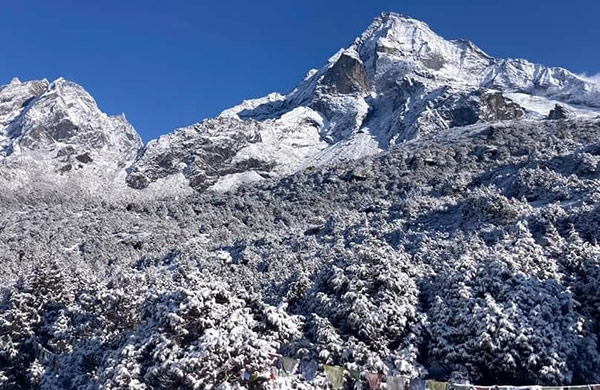
This Everest Circuit trek involves 3 commanding vantage points titillatingly close to Everest. After the flight to Lukla (not included in price) (Day 1 – 2,840m), the first destination is the Sherpa village of Namche Bazaar (Days 2 & 3 – 3,440m), then through the 4,500m contour to trek up to the west flank of the Longponga Glacier and make an ascent to the Gokyo-Ri (Day 7 – 5,430m). Everest appears in the east in the hallo of the sunrise.
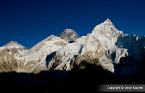
The route then continues by cautiously crossing the lower section of the Glacier and an early start is required to cross the Cho La (day 9 – 5,378m). If indeed the Yeti exists, then surely this must be his abode. The landscape is 6,000m hillocks and the horizon is dotted with 7,000 & 8,000m giants and mega-giants, namely Cho Oyo (8,153m), Nuptse (7,879m), Lhoste (8,501m), and the mighty Everest (8,848m) towering above them all.
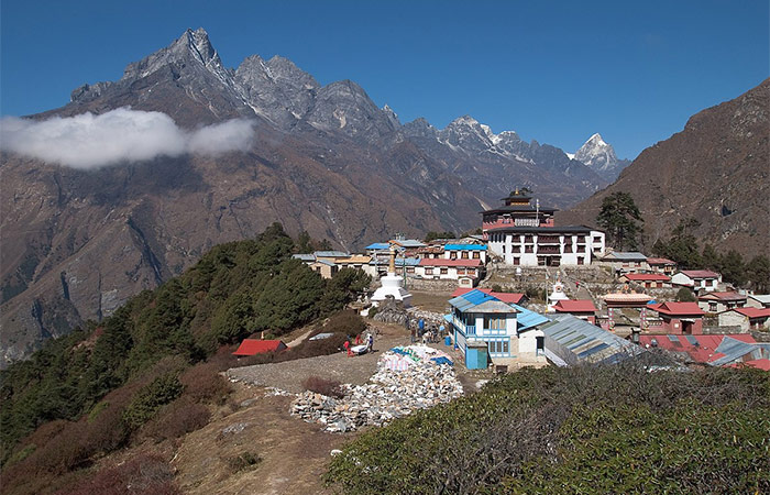
On this Everest Circuit trek, Kala Patter (day 12 – 5,545m) is our final destination, puts Everest right up there, just beyond and above Khumbu Glacier. Nuptse and Lhotse take up there position as forward sentinels, and the incredible icefall bars all further direct approaches. The tranquillity of the Tyangboche Monastery leaves a definitive impression on you on your way back to home via Lukla.
Transfer from airport to hotel. Pre-trek briefing by your trekking guide.
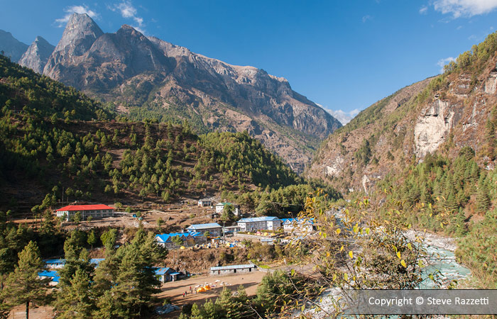
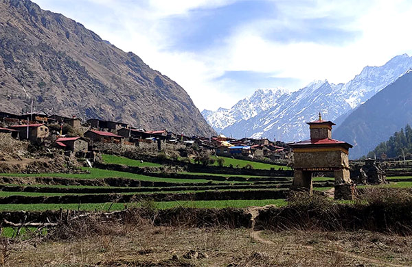
We take an early morning stunning flight to Lukla 2,800m/9,800ft (40mins approx), gateway to The Everest. We are now in the region of the legendary Sherpas whose features are much more distinct from the rest of the Nepalese you’ve encountered so far. After lunch, we trek north towards Phakding along meandering trails which are lined with mani stone walls, made with hundreds of stone tablets and giant carved boulders, brilliantly adorned with brightly coloured paints. This portion of the hike is an easy walk through the lush landscape of the Himalayan lowlands.
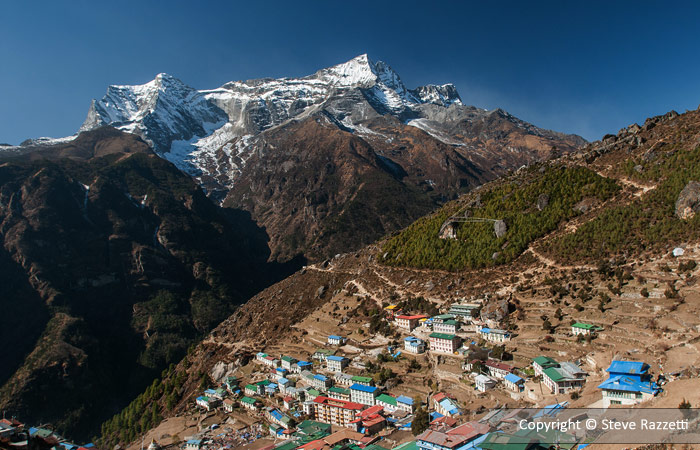
Following the Dudh Koshi, the trail heads north as it gently starts to rise through rhododendron & magnolia forests with giant fir trees to the village of Jorsalle, where the lunch break will be taken. After a brief stop-over for lunch, the climb proceeds towards Namche Bazaar, a delightful mountain village and so-called ‘Sherpa Capital’ of Khumbu.
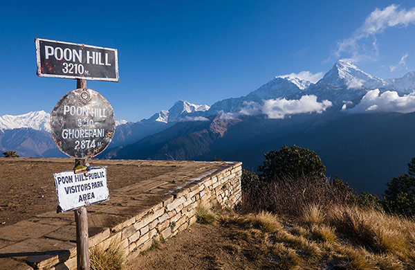
We take a day off to get acclimatised to the high altitude In the meantime, one can explore the local markets, mingle with the people, walk up to the Everest view point, visit the museum ,and happily laze around and bask in the sun later in the afternoon.
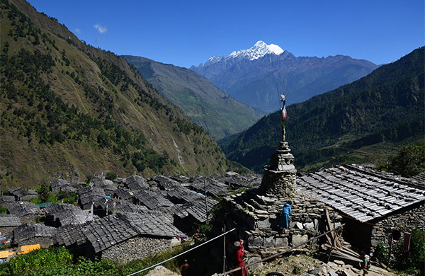
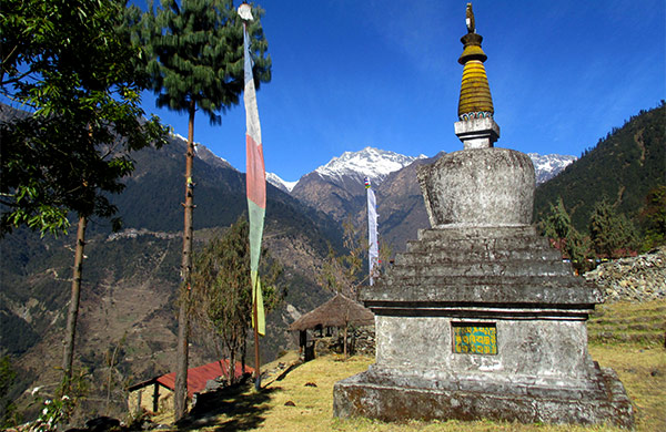
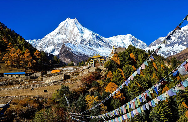
The beginning of the trail is almost level-stretched and abruptly the passage ascends on a staircase made up of rocks embedded in a narrow cleft in a large boulder and continues towards a large chorten (a smaller version of Stupa) on the top of the ridge which is in Mong La, the birth place of the saint Lama Sange Dorje, the reincarnate lama of Rongbuk monastery in Tibet who introduced Buddhism to Khumbu.
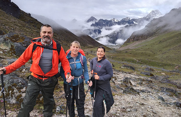
From Mong La, the trail descends in steep switchbacks down a sandy slope to the Dudh Koshi river for short period and then climbs steeply out of the valley through rhododendron forests, which give way to fragrant stands of juniper and large conifers as the elevation increases. The trail passes a herders’ hut at Tongba, then ascends smoothly to Dole with few lodges and predominant views of Khumbila , the abode of the patron god of the Khumbu region, and Tawache. From here on, it is possible to climb a ridge behind Dole for a broader view up and down the valley.
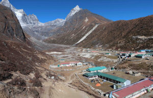
This day the route is steep in few places as it climbs through scrub junipers and along the way Kharkas (grazing field for yaks) are seen wherever there is a flat spot and the slightest hint of water. Most of the Kharkas are noticeable at Luza and people from Khumjung own them. The trail carries on to climb along the side of the valley, high above the river, traversing sandy spurs to Machhermo, where a yeti had killed three yaks and had attacked a Sherpa girl, the most credible yeti incident ever reported in Khumbu, so be on guard as you visit this region.
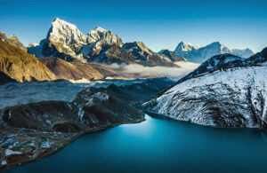
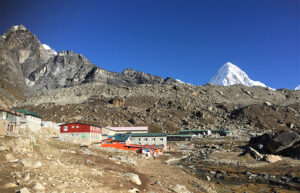
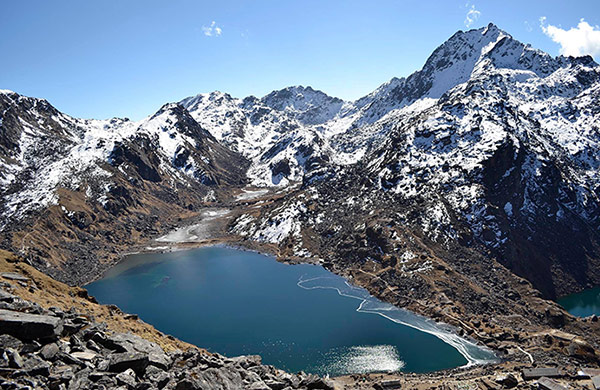
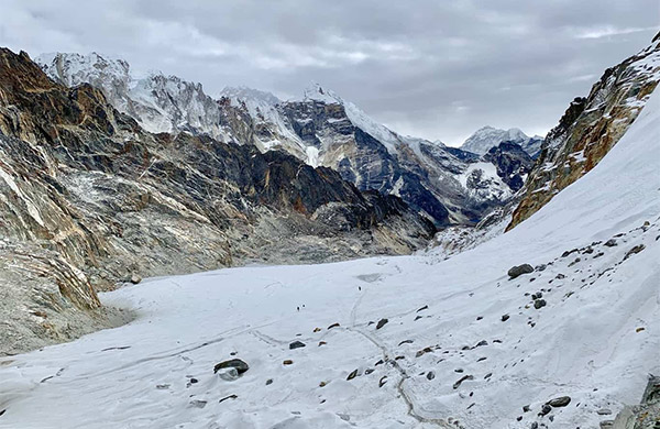
Away from Macchermo the trail ascends a ridge for an excellent view both down the valley to Kantega and up towards Cho Oyu. Further than the ridge, the valley widens as the trail reaches Pangka and leaving this place behind you drop briefly, then again climb to a large cave area known as Nilibuk. As we pass Nilibuk the trail climbs steeply along a narrowly crafted staircase trail and down below, the clear water from the Gokyo lakes merging with the glacial outflow from the massive Ngozumpa Glacier is seen. Atop the staircase, the trail crosses a simple wooden bridge to the first small lake, where a family of Brahminy ducks has dwelled for many years. Head on past a second lake known as Taujun, and finally up a boulder strewn path to Gokyo, a collection of stone houses.
In Gokyo, we again take a day off to acclimatise. After early morning breakfast, hike up to Gokyo-Ri (5357m, 2 hrs approx), the small peak above the lake. The place offers an astonishing panoramic view of Cho Oyu, Gyachung Kang, Everest, Lhotse, Kakalu, Cholatse and Tawachee. This small peak is sometimes called Kala Patthar (which is entirely different from Kala Patthar above Gorakshep).
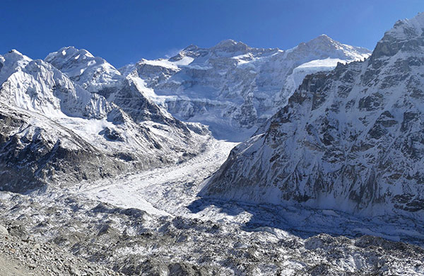
The route we trek today is a challenging side trip across Cho La to the Khumbu valley into the Everest region. Just about halfway between the first and second lakes, a trail leads across the moraine to the east past the steep pass , which involves a glacier crossing on the eastern side finally reaching Thangna with a small number of houses where we make a night stop for crossing Cho La pass the following day.
We wake up earlier than usual to prepare for the challenging trek across Cho La pass. We’ve to pack our lunch for the day as houses and lodges are non-existent on the route. Besides moraine trail you may come across ice falls, if there had been enough snowfall in the region.
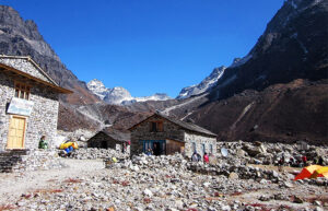
The trail, which comprises moraine and rocks, towards Cho La (5340) is comparatively steep with snow capped upper part. The descent from the pass to Dzongla is quite straightforward.
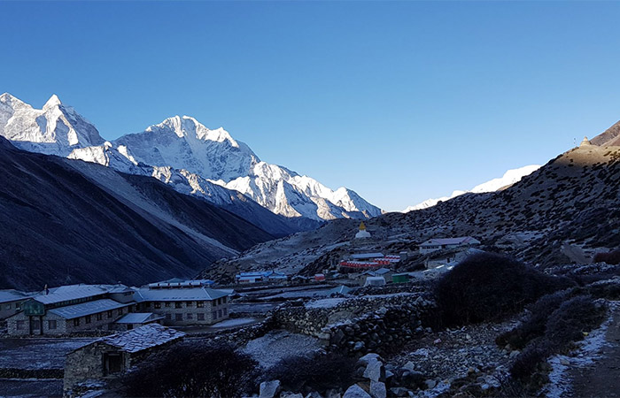
Leaving Dzongla, the trail continues to descend. Walking past frozen rivers, we reach Lobuche where stone houses sit in an icy wilderness of stunning beauty. Once in Lobuche, you get the sense of being close to the ultimate goal.
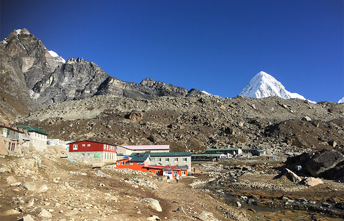
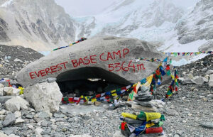
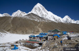
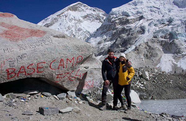
Today you will spend the whole day trekking to the Base Camp and then back to Gorakshep. Your trek Sirdar will navigate the Khumbu glacier as you make your way to The Base Camp of Mount Everest. You will be standing at the base of the tallest mountain on Earth and shall see the infamous Khumbu icefall. Reaching Basecamp fills you with a real sense of achievement as you’ve done what you set out to do and stare in awe at the spectacular surroundings. Soon it will be time to descend back to Gorakshep for the overnight halt.
The day will start earlier than usual with the aim of reaching Kala Patthar before sunrise, the best vantage point for viewing Everest and the other surrounding peaks. A feeling of being in unison with the mighty nature overwhelms you as you ascend to the top of Kala Patthar. The views are amazing and Everest is breath taking. Continue to descend to sandy flat expanse of Gorakshep, and continue the trek down to Dingboche where mountains views are terrific.
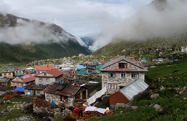
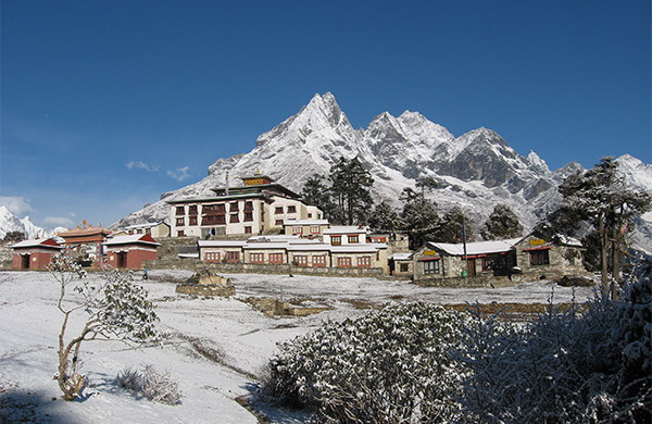
The route descends from the Imja valley, then traverses across the Khumbu Khola on a wooden bridge and ascends to rejoin the upward trail near Orsho and continues to descend passing several yak herders and tea shops to Shomare. Leaving behind alpine meadows, we get down to the tree line for our night stop in Tyangboche, the religious focal point of the entire ‘Sherpa land’, where you can visit the largest monastery of Nepal that was founded in 1919 by Lama Gulu, a monk from Khumjung.
Descend through the woods to Phunki Tenga, then uphill to Kenjoma. Retrace your steps back past Namchhe to Monjo .
The last day in Khumbu Region. The trail that is followed is fairly easy with some steady climbs through scrub forests with a final steep ascent that leads to a Tamang village and shortly thereafter to Lukla, where the time to relax in Sherpa ambience is abundant.
Optional day in hand for bad weather contingency, additional acclimatization or detour.
Short but spectacular flight will bring you back to Kathmandu. You can spend rest of the day exploring, shopping or simply just relaxing in numerous cafes in Thamel before the entire group meets for the end of the trek celebration dinner at The Rum Doodles.
Free day for rest & relax or exploration in city (services available for any sort of arrangements).
Transfer from hotel to airport.
Trekking in Nepal
5/5 Excellent
Trekking in Nepal
5/5 Excellent
Trekking in Nepal
5/5 Excellent
Trekking in Nepal
4/5 Excellent
Trekking in Nepal
3/5 Excellent
Trekking in Nepal
3/5 Excellent
Trekking in Nepal
4/5 Excellent
Trekking in Nepal
5/5 Excellent
Trekking in Nepal
4/5 Excellent
Trekking in Nepal
4/5 Excellent
Trekking in Nepal
1/5 Excellent
Trekking in Nepal
3/5 Excellent
Trekking in Nepal
4/5 Excellent
Trekking in Nepal
1/5 Excellent
Trekking in Nepal
1/5 Excellent
Trekking in Nepal
3/5 Excellent
Trekking in Nepal
5/5 Excellent
Trekking in Nepal
3/5 Excellent
Trekking in Nepal
3/5 Excellent
Trekking in Nepal
5/5 Excellent
Copyright © 2024 Adventure Challenge Centre. All Rights Reserved
Crafted with by : Nepal-web.com